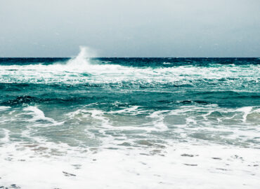

Many people associate tsunamis with places like Japan and Indonesia, and that’s no surprise. After all, these countries are located in a region known for its high potential of tsunami-inducing seismic activity, the Pacific Ring of Fire. However, what many residents of British Columbia—and perhaps many Canadians, in general—don’t know is that BC is also situated along this Ring of Fire. So yes, there has been a tsunami storm in British Columbia.
This is relevant because, while tsunamis can strike any coast, this particular region of the world is highly prone to this natural hazard. In fact, the National Oceanic and Atmospheric Administration (NOAA), a U.S. scientific and regulatory agency that is tasked with the study of the Earth’s oceans, atmosphere, and coastal areas, notes that 78% of tsunamis are most likely to occur in the Pacific Ocean, particularly around this Ring of Fire.
In addition, British Columbia has active volcanoes. In fact, Canada’s five potentially active volcanic areas are all in British Columbia and the Yukon Territory. These two areas have recorded at least 49 volcanic eruptions during the last 10,000 years. Along with earthquakes and landslides, volcanic eruptions are another most common cause of tsunamis.
With all these components in place, it’s no wonder then that British Columbia has had its share of tsunamis in the past and should expect them in the future as well.
To understand the real tsunami risk in British Columbia, it’s important to look back at the province’s history with this natural hazard. BC’s tsunami history spans centuries, from the catastrophic Cascadia earthquake of 1700 to more recent events in the 21st century. These incidents all left lasting marks on the province’s coastal communities and shaped modern emergency preparedness efforts.
BC First Nations’ Experience with Tsunamis
Long before colonists ever reached the shores of British Columbia, the region was already inhabited by First Nations tribes. Oral narratives or stories about tsunamis wiping out entire villages have been passed on from generation to generation. Here are a couple of them.
- Knight Inlet Tsunami (16th Century)
According to oral historical accounts of the A’wa’etlala and Da’naxda’xw peoples, a First Nations village in Knight Inlet on the central coast of mainland BC was hit by a devastating tsunami sometime in the 16th century.
Kwalate was a major village of around 100 or more people that was situated along the shore of a “funnel-shaped bay.” It stretched 90 miles (around 145 km) along the Knight Inlet shoreline and was believed to have been occupied from the late 1300s CE to the late 1500s CE.
The tsunami that struck Kwalate was the result of a rock avalanche, which dropped down from a height of 840 meters (about 2,800 feet) into the water of the opposite side of the fjord. The resulting tsunami is estimated to have been 2-5 meters (around 6.5-15 feet) in height.
Franz Boas, a German-American anthropologist who is often referred to as the “father of American anthropology,” wrote in his book Kwakiutl Tales:
- “About three generations ago, or possibly at an earlier date, a large portion of the mountain opposite Kwalate Point slid into the inlet causing a huge tidal wave which wiped out all of the inhabitants of the village opposite…and the vast slide is noticeable today”.
- The M9 Cascadia Earthquake Tsunami (1700)
This is another significant tsunami recorded in the oral histories of First Nations and Native American tribes of the Pacific Northwest. While the stories vary from tribe to tribe, one thing was certain: The tsunami caught the indigenous groups of North America unaware and unprepared.
It was nighttime on January 26, 1700 when villagers of the Cowichan Tribes First Nation were awoken by a violent shaking. Houses were brought down or buried and people could neither sit nor stand.
The undersea Cascadia thrust fault had ruptured along a 1,000 km ( mile) length from mid Vancouver Island to northern California. The fault is the boundary between the North American and Juan de Fuca plates.
The consequences of the resulting tsunami that followed the massive earthquake were catastrophic. Some First Nations villages were completely wiped out. For instance, the village of the Huu-ay-aht First Nation near Pachena Bay was destroyed with no survivors. And, an orphan tsunami even reached the shores of Japan.
1960s Tsunamis
In the 1960s, a couple of tsunamis resulting from magnitude 9+ earthquakes once again wreaked havoc on British Columbia
- Valdivia Earthquake Tsunami (1960)
On May 22, 1960, a magnitude 9.5 earthquake hit southern Chile, and the consequences reverberated throughout the Pacific. The epicenter of the quake was near Valdivia, which suffered the most damage, including 2 million homeless people, 3,000 injured, around 1,655 dead, and economic damages totaling $550 million.
The largest earthquake in recorded history gave rise to massive tsunamis that raced across the Pacific to reach coastal communities as far away as Japan, the Philippines, and New Zealand. In British Columbia, the waters rose 1.2 meters (nearly 4 feet) high at the Tofino tide gauge, with higher run-ups in many areas. The tsunami also damaged log booms along the coast of Vancouver Island and Haida Gwaii.
- The 1964 Port Alberni Tsunami (1964)
On the afternoon of Good Friday, March 27, 1964, the strongest earthquake recorded in North America, occurred in the Prince William Sound region of Alaska. It registered as a magnitude 9.2 earthquake on the Richter Scale and triggered a tsunami that reached Haida Gwaii and Vancouver Island. Port Alberni in Vancouver Island was hit the worst.
“Around midnight the first two waves started traveling up the 40 kilometer Alberni inlet to Alberni and Port Alberni,” the Port Alberni Maritime Heritage Society recounts. “No one expected the tsunami to hit as hard as it did because we are in the middle of an island; but it’s because of our inlet that the tsunami did hit so hard.”
The tsunami ruined hundreds of houses and vehicles and buildings were dragged to the sea. The total damage bill came at an estimated $5 million.
Chehalis Lake Tsunamis (2007, 2020)
Tsunamis don’t occur only in oceans. In 2007 and 2020, two lake tsunamis were reported in Chehalis Lake in southwestern British Columbia.
In December 2007, heavy rain falling on snow caused a massive landslide in Mount Orrock, which sent a wave up the opposite shore and down the lake’s entire length. The large wave of more than 10 meters (around 32 feet) high damaged or destroyed campgrounds and forests in the surrounding area.
The event was repeated in 2020. This time, the resulting lake tsunami reached 100 meters (feet), sending a torrent of water into Elliot Creek and uprooting trees in its path.
Summary of British Columbia Tsunamis
Below is a list of the tsunamis that have hit British Columbia from the turn of the 16th century until the 21st century.
Table 1. Timeline of Tsunami Events in British Columbia
| Date | Location | Impact |
| Around the 16th century | Knight Inlet | Local coastal impact |
| January 26, 1700 | Outer coast | Widespread coastal impact |
| August 13, 1905 | Spences Bridge | Local river impact |
| June 23, 1946 | Deep Bay, Strait of Georgia | Local lake impact |
| May 23, 1960 | Outer coast | Widespread coastal impact |
| March 28, 1964 | Outer coast | Widespread coastal impact |
| April 27, 1975 | Kitimat | Local coastal impact |
| October 6, 1998 | Troitsa Lake | Local lake impact |
| December 4, 2007 | Chehalis Lake | Local lake impact |
Source/s: J. M. Aylsworth, Geological Survey of Canada, Natural Resources Canada